A Well-Summarized Collection of Security Tourism Attractions Course
Korean name제대로 요약정리한 안보 관광명소 모음 코스
Machine-translated from Korean. Show original
A course connecting Hwacheon County, Yanggu County, and Goseong County, looking toward North Korean territory, and a collection of security tourism attractions leading to pristine nature and the rainbow coastal road
Details
- Chilseong Observatory
- The Chilseong Observatory was built in 1991, and after about 21 years, the building and some internal viewing facilities were partially damaged and deteriorated, so on April 19, 2013, it was newly remodeled to suit a modern sense and developed as a security tourism product. On the day of the tour, bring your ID, fill out an application at the Chilseong Observatory Information Center, and depart simultaneously with the guide on board. At the Chilseong Observatory, you can see the Geumseongcheon Stream, the only stream in South Korea that flows north and then into the Peace Dam, enjoy the beautiful scenery of North Korea's mountains and fields, and observe wildlife within the DMZ.
- Haesan Observatory
- Haesan, whose name means 'mountain where the sun rises,' is a beautiful mountain with a height of 1,194 m above sea level. It is also called Ilsan (日山) or Horangi-san (Tiger Mountain). Because it was located in the Civilian Control Zone, travelers' access was restricted in the past, but now anyone can visit. From the Haesan Observatory on the mountain, you can take in a panoramic view of Paro Lake, which lies close by.
- Hwacheon Market (3rd, 8th)
- Hwacheon Market is a five-day market held on the 3rd and 8th of every month, where pollution-free agricultural and fishery products produced in the clean areas of the district, wild vegetables, clothing, and miscellaneous goods vendors gather to form a bustling market. Because goods can be purchased cheaply, it is widely used by residents.
- Dutayeon (Gangwon Peace Area National Geopark)
- As a Civilian Control Line area, you can apply in advance for entry through the Yanggu Security Tourist Site Integrated Reservation Site or register on-site on the day of visit. On the day of visit, fill out the entry application and pledge at the Geumgangsan Information Center, wear a GPS device, and depart on time from the Geumgangsan Information Center under the guidance of a guide. You must tour the Dutayeon Parking Lot -> Ecological Trail -> Dutayeon Parking Lot section, which is the Ecological Trail, for about 1 hour and return at the designated time.
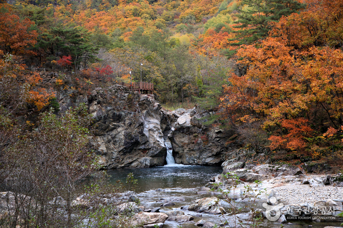
Dutayeon is a waterfall and plunge pool formed when the Sataecheon Stream, a tributary of the Suipcheon Stream, meandered through a mountainous area (an incised meander), and a bend of the stream was cut off (meander cutoff). A plunge pool refers to a deep, round, hollow pool at the base of a waterfall, formed as falling water, together with gravel and other materials, abrades the lower part of the waterfall (corrasion) or tears it away by water pressure (hydraulic excavation). Meanwhile, the place name Dutayeon originates from the fact that there was a temple called Dutasa nearby. - Goseong Unification Observatory Tower
- Standing at the Unification Observatory, located on a 70 m-high hill where the Armistice Line and the Southern Limit Line meet, one can see the Guseonbong Peak of Mount Geumgang and Haegeumgang nearby, and on clear days, Oknyeobong, Chaehabong, and Ilchulbong Peaks. The front-line outpost facing off across the Armistice Line barbed-wire fence below instills a sense of tension between North and South Korea. As a representative tourist attraction of Goseong visited by more than 1.5 million tourists annually, it features religious auxiliary facilities such as a statue of the Virgin Mary, a Maitreya Buddha statue, and a forward iron tower for displaced people longing for the mountains and families left behind in the North and for those wishing for unification, as well as exhibits for security education including armored vehicles, tanks, and aircraft. Below, one can see the inter-Korean connecting road of the Donghae Line, opened in December 2004, where overland tours to Mount Geumgang take place.
- Ayajin Beach
- This place, 6km north of Sokcho and about 500m in from National Route 7, has beautiful surrounding scenery, and the number of summer visitors increases every year. Large and small rocks, clear sea, and clean white sand beach combine to make it suitable as a family summer resort. The white sand beach is 600m long and 50m wide, and the water depth is 1.5~2m up to 30m from the beach. Here, you can buy fresh squid cheaply early in the morning, so more people are deliberately visiting this place.
Visitor reviews 0
Videos of this place
Hwacheon-gun travel resources
All guides →- e-book
- GuidesYour New Korea, Healing Gangwon Travel
- e-book
- GuidesHealing Gangwon - Themed Travel to Gangwon Province